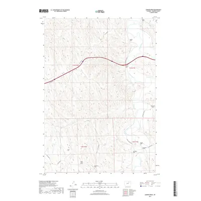
2017 Map of Juniper Draw
USGS Topo · Published 2017About this map
The Powder River meanders through this portion of Johnson County, defining a landscape of high plains and drainage basins. This area is characterized by significant topographical features such as Indian Creek Divide and Monument Hill, which overlook expansive stretches like Nines Flat and Big Mikes Flat. The map reveals a network of rural routes, including Schoonover Rd and Dry Creek Rd, which provide access across the numerous draws that carve the terrain.
Find a feature on this map
23 named features on this map. Tap any name to fly to it.
Don’t see what you’re looking for? This feature index may not catch every label — zoom into the map to look around manually.
Map Details
Editions of this 2017 Juniper Draw Map
This is the sole edition of this map. No revisions or reprints were ever made.
Other maps of this area

1955 · Sheridan
USGS Topo · 1:250,000

1958 · Sheridan
USGS Topo · 1:250,000

1962 · Sheridan
USGS Topo · 1:250,000
1972 · Ploessers Draw
USGS Topo · 1:24,000
1972 · Laskie Draw
USGS Topo · 1:24,000
1972 · Bear Draw
USGS Topo · 1:24,000
1972 · Somerville Flats West
USGS Topo · 1:24,000
1972 · Negro Butte
USGS Topo · 1:24,000
1972 · Bowman Flat
USGS Topo · 1:24,000
1972 · Juniper Draw
USGS Topo · 1:24,000