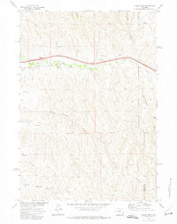
1972 Map of Laskie Draw
USGS Topo · Published 1975About this map
The high plains of the Powder River Basin reveal a complex network of ephemeral drainages and vital water improvements in this 1970s survey. Running across the northern half of the quadrangle, Dead Horse Creek serves as a primary geographic anchor, accompanied by man-made catchments like Laskie Reservoir and the uniquely named Bombsite Reservoir. This era of land management is defined by the widespread distribution of groundwater sources, indicated by numerous scattered Flowing Well labels and the Vomburg Well.
Find a feature on this map
17 named features on this map. Tap any name to fly to it.
Don’t see what you’re looking for? This feature index may not catch every label — zoom into the map to look around manually.
Map Details
Editions of this 1972 Laskie Draw Map
This is the sole edition of this map. No revisions or reprints were ever made.
Other maps of this area

1954 · Gillette
USGS Topo · 1:250,000

1955 · Sheridan
USGS Topo · 1:250,000

1955 · Gillette
USGS Topo · 1:250,000

1958 · Gillette
USGS Topo · 1:250,000

1958 · Sheridan
USGS Topo · 1:250,000

1962 · Gillette
USGS Topo · 1:250,000

1962 · Sheridan
USGS Topo · 1:250,000
1971 · Bogie Draw
USGS Topo · 1:24,000
1971 · Morgan Draw
USGS Topo · 1:24,000
1972 · Carr Draw
USGS Topo · 1:24,000