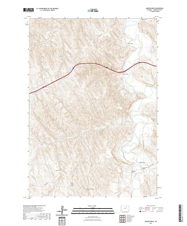
2021 Map of Juniper Draw
USGS Topo · Published 2021About this map
The Powder River meanders through this portion of Johnson County, cutting through a landscape defined by complex drainage systems and named plateaus. Local landmarks like Schoonover Bridge and the Petes Reservoir reflect the intersection of water management and rural transit in this arid region. The terrain is marked by significant topographical features such as Monument Hill and the Indian Creek Divide, which separate the various draws feeding into the river. These features, including Juniper Draw, Bugher Draw, and Burger Draw, illustrate the intricate erosion patterns of the northern Wyoming plains. To the west, the map details open expanses like Nines Flat and Big Mikes Flat, providing a clear view of the land use and ranching history in the township and range system at the start of the 2020s.
Find a feature on this map
24 named features on this map. Tap any name to fly to it.
Don’t see what you’re looking for? This feature index may not catch every label — zoom into the map to look around manually.
Map Details
Editions of this 2021 Juniper Draw Map
This is the sole edition of this map. No revisions or reprints were ever made.
Other maps of this area

1955 · Sheridan
USGS Topo · 1:250,000

1958 · Sheridan
USGS Topo · 1:250,000

1962 · Sheridan
USGS Topo · 1:250,000
1972 · Ploessers Draw
USGS Topo · 1:24,000
1972 · Laskie Draw
USGS Topo · 1:24,000
1972 · Bear Draw
USGS Topo · 1:24,000
1972 · Somerville Flats West
USGS Topo · 1:24,000
1972 · Negro Butte
USGS Topo · 1:24,000
1972 · Bowman Flat
USGS Topo · 1:24,000
1972 · Juniper Draw
USGS Topo · 1:24,000