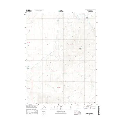
2016 Map of Juniper Mountain
USGS Topo · Published 2016About this map
Juniper Mountain dominates the center of this Moffat County landscape, rising above the winding path of the Yampa River as it cuts through Juniper Canyon. This modern topographic survey illustrates the intersection of natural water systems and agricultural infrastructure, particularly evident in the Maybell Ditch which draws from the river to support local irrigation. To the west, the presence of the Dry Lake Reservoir and the drainage of Deception Cr highlight the critical role of water management in this arid region. The map also records several remote water sources like Boxelder Spring and the drainage of Lay Cr in the north. This terrain is largely defined by public land sections and a sparse network of county roads, such as Co RD 57 and Co RD 59, which provide access through the complex topography of Brush Draw.
Find a feature on this map
19 named features on this map. Tap any name to fly to it.
Don’t see what you’re looking for? This feature index may not catch every label — zoom into the map to look around manually.
Map Details
Editions of this 2016 Juniper Mountain Map
This is the sole edition of this map. No revisions or reprints were ever made.
Other maps of this area

1907 · White River
USGS Topo · 1:125,000

1910 · Danforth Hills
USGS Topo · 1:125,000

1910 · White River
USGS Topo · 1:125,000

1912 · Axial
USGS Topo · 1:62,500

1914 · Axial
USGS Topo · 1:62,500

1916 · Craig
USGS Topo · 1:125,000

1954 · Vernal
USGS Topo · 1:250,000

1954 · Craig
USGS Topo · 1:250,000

1957 · Craig
USGS Topo · 1:250,000

1958 · Vernal
USGS Topo · 1:250,000