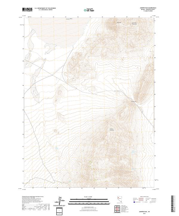
2021 Map of Juniper Pass
USGS Topo · Published 2021About this map
Sahwave Mountains dominate the central terrain of this Pershing County landscape, where the high desert topography converges at Juniper Pass. This 2021 survey by the U.S. Geological Survey illustrates a land shaped by drainage patterns and isolation, with the Kumiva Valley opening to the north. The presence of several vital water sources, such as West Juniper Spring and North Cottonwood Spring, indicates the traditional points of survival and travel for those navigating the western reaches of the Blue Wing Mountains. The map provides a detailed view of the high points, including Black Mtn, revealing the complex ridgelines and drainage basins that define this portion of the Great Basin.
Find a feature on this map
15 named features on this map. Tap any name to fly to it.
Don’t see what you’re looking for? This feature index may not catch every label — zoom into the map to look around manually.
Map Details
Editions of this 2021 Juniper Pass Map
This is the sole edition of this map. No revisions or reprints were ever made.
Other maps of this area

1886 · Granite Range
USGS Topo · 1:250,000

1894 · Granite Range
USGS Topo · 1:250,000

1931 · Lovelock
USGS Topo · 1:250,000

1935 · Lovelock
USGS Topo · 1:250,000

1955 · Lovelock
USGS Topo · 1:250,000

1959 · Lovelock
USGS Topo · 1:250,000
1981 · Bluewing Flat South
USGS Topo · 1:24,000

1981 · Twin Buttes Well
USGS Topo · 1:24,000
1981 · Tunnel Spring
USGS Topo · 1:24,000

1981 · Bluewing Flat North
USGS Topo · 1:24,000