
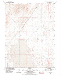
1981 Map of Bluewing Flat North
USGS Topo · Published 1981About this map
Bluewing Mountains dominate the northern terrain of this Pershing County landscape, where the high desert peaks transition into the broad, arid expanse of the Granite Springs Valley. The map records a classic Great Basin environment of alluvial fans and dry alkali basins, specifically the southern reaches of Bluewing Flat. This 1981 edition, compiled by the U.S. Geological Survey from mid-1970s aerial photography, captures the region's character as a site of mineral interest and sparse settlement. Human activity is evidenced by a scattered prospect, reflecting the persistent search for resources within the desert floor and surrounding foothills. The network of jeep trails and unimproved roads shown here indicates the area's continued use for exploration and land management during the late twentieth century.
Find a feature on this map
4 named features on this map. Tap any name to fly to it.
Don’t see what you’re looking for? This feature index may not catch every label — zoom into the map to look around manually.
Map Details
Editions of this 1981 Bluewing Flat North Map
2 editions found
Other maps of this area

1886 · Granite Range
USGS Topo · 1:250,000

1894 · Granite Range
USGS Topo · 1:250,000

1931 · Lovelock
USGS Topo · 1:250,000

1935 · Lovelock
USGS Topo · 1:250,000

1955 · Lovelock
USGS Topo · 1:250,000

1959 · Lovelock
USGS Topo · 1:250,000
1981 · Bluewing Flat South
USGS Topo · 1:24,000

1981 · Twin Buttes Well
USGS Topo · 1:24,000
1981 · Seven Troughs
USGS Topo · 1:24,000
1981 · Lowry Well
USGS Topo · 1:24,000