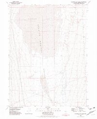
1981 Map of Bluewing Flat South
USGS Topo · Published 1981About this map
Granite Springs Valley dominates this high-desert landscape in Pershing County, where the stark topography of Nevada's Great Basin is recorded with precision. The map centers on the transition from the expansive Bluewing Flat to the north into the broader valley floor, capturing a segment of the desert characterized by seasonal drainage patterns and sparse infrastructure. The presence of Sage Hen Wash illustrates the intermittent water flow that defines this arid terrain, while a lone Water Tank on the eastern edge serves as a rare indicator of human utility in an otherwise uninhabited stretch of the basin. This 1981 edition, based on mid-1970s aerial photography, provides a clear view of the natural contours and drainage networks before any modern large-scale alterations, making it a valuable reference for understanding the primitive state of this remote Nevada valley.
Find a feature on this map
4 named features on this map. Tap any name to fly to it.
Don’t see what you’re looking for? This feature index may not catch every label — zoom into the map to look around manually.
Map Details
Editions of this 1981 Bluewing Flat South Map
This is the sole edition of this map. No revisions or reprints were ever made.
Other maps of this area

1886 · Granite Range
USGS Topo · 1:250,000

1894 · Granite Range
USGS Topo · 1:250,000

1931 · Lovelock
USGS Topo · 1:250,000

1935 · Lovelock
USGS Topo · 1:250,000

1955 · Lovelock
USGS Topo · 1:250,000

1959 · Lovelock
USGS Topo · 1:250,000

1981 · Bluewing Flat North
USGS Topo · 1:24,000
1981 · Ragged Top Mtn
USGS Topo · 1:24,000
1981 · Bluewing Spring
USGS Topo · 1:24,000
1981 · Lowry Well
USGS Topo · 1:24,000