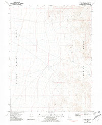
1981 Map of Lowry Well
USGS Topo · Published 1982About this map
Granite Springs Valley dominates the western half of this Nevada landscape, transitioning into the elevation of the Trinity Range to the east. This early 1980s survey captures a remote region defined by mining activity and limited water sources, centered on the named Lowry Well. At the northern edge of the range, the Velvet Mine stands as a primary point of interest, surrounded by various unidentified Prospects that indicate the area's mineral-driven history. The map's detail provides a clear record of the section lines and township boundaries, including the intersection of T 27 N and T 28 N, essential for property research and land-use studies in this high-desert environment.
Find a feature on this map
8 named features on this map. Tap any name to fly to it.
Don’t see what you’re looking for? This feature index may not catch every label — zoom into the map to look around manually.
Map Details
Editions of this 1981 Lowry Well Map
This is the sole edition of this map. No revisions or reprints were ever made.
Other maps of this area

1931 · Lovelock
USGS Topo · 1:250,000

1935 · Lovelock
USGS Topo · 1:250,000

1955 · Lovelock
USGS Topo · 1:250,000

1956 · Toulon
USGS Topo · 1:62,500

1959 · Lovelock
USGS Topo · 1:250,000
1981 · Bluewing Flat South
USGS Topo · 1:24,000

1981 · Bluewing Flat North
USGS Topo · 1:24,000
1981 · Ragged Top Mtn
USGS Topo · 1:24,000

1981 · Trinity Pass
USGS Topo · 1:24,000
1981 · Seven Troughs SE
USGS Topo · 1:24,000