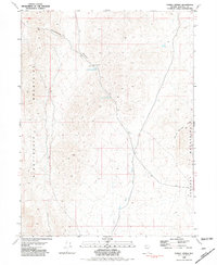
1981 Map of Tunnel Spring
USGS Topo · Published 1981About this map
Tunnel Spring and the surrounding high desert terrain define this corner of Nevada, where the drainage of Stonehouse Canyon and Sage Hen Wash cut through a landscape shaped by significant elevation changes. Situated between the Nightingale Mountains to the west and the Sahwave Mountains to the east, the area is punctuated by critical water sources including Upper Stonehouse Spring and Lower Stonehouse Spring. The presence of these named springs and a central Water Tank indicates the vital importance of water management in this arid Pershing County environment during the early 1980s. A network of 4wd tracks provides the only access across the basins and ridges, such as Granite Springs Ridge, illustrating the isolated and undeveloped character of the Great Basin during this era.
Find a feature on this map
10 named features on this map. Tap any name to fly to it.
Don’t see what you’re looking for? This feature index may not catch every label — zoom into the map to look around manually.
Map Details
Editions of this 1981 Tunnel Spring Map
This is the sole edition of this map. No revisions or reprints were ever made.
Other maps of this area

1886 · Granite Range
USGS Topo · 1:250,000

1894 · Granite Range
USGS Topo · 1:250,000

1955 · Lovelock
USGS Topo · 1:250,000

1959 · Lovelock
USGS Topo · 1:250,000
1964 · Tohakum Peak NE
USGS Topo · 1:24,000
1964 · Tohakum Peak SE
USGS Topo · 1:24,000

1964 · Kumiva Peak
USGS Topo · 1:62,500
1981 · Sage Hen Spring
USGS Topo · 1:24,000
1981 · Bluewing Spring
USGS Topo · 1:24,000
1981 · Jayhawk Well
USGS Topo · 1:24,000