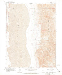
1964 Map of Tohakum Peak SE
USGS Topo · Published 1965About this map
The arid landscape of the Nightingale Mountains meets the expansive basin of Winnemucca Lake in this mid-1960s topographic record. This area of Nevada is defined by significant elevation changes, ranging from the flat lakebed to high peaks connected by a network of rudimentary transportation routes including a Jeep Trail and Pack Trail. Industrial activity is localized at the MGL Mines, where the map records a high-elevation operation with several springs nearby to support the site. The western portion of the map is dominated by the Pyramid Lake Indian Reservation boundary, which follows the lake's eastern shore. A notable geographic feature is the Indefinite Boundary running through the center of the dry lake bed, marking the transition between Washoe and Pershing counties across the alkaline flats.
Find a feature on this map
12 named features on this map. Tap any name to fly to it.
Don’t see what you’re looking for? This feature index may not catch every label — zoom into the map to look around manually.
Map Details
Editions of this 1964 Tohakum Peak SE Map
2 editions found
Other maps of this area

1886 · Granite Range
USGS Topo · 1:250,000

1890 · Wadsworth
USGS Topo · 1:125,000

1892 · Wadsworth
USGS Topo · 1:125,000

1894 · Granite Range
USGS Topo · 1:250,000

1894 · Wadsworth
USGS Topo · 1:125,000

1955 · Lovelock
USGS Topo · 1:250,000

1957 · Fireball Ridge
USGS Topo · 1:62,500

1957 · Nixon
USGS Topo · 1:62,500

1957 · Reno
USGS Topo · 1:250,000

1959 · Lovelock
USGS Topo · 1:250,000