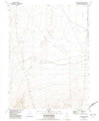
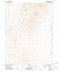
1981 Map of Jayhawk Well
USGS Topo · Published 1982About this map
Kumiva Valley dominates this 1980s topographic perspective of the high desert along the border of Nevada’s Pershing and Washoe counties. The landscape is defined by its arid hydrology and sparse human infrastructure, centered on the Jayhawk Well and a solitary Corral located in the eastern portion of the valley. While topographic contours describe the basin floor and the surrounding rising terrain, the presence of a notable Depression in the northeast quadrant highlights the internal drainage patterns typical of this Great Basin environment. Land divisions for T 28 N and the ranges R 24 E and R 25 E provide a cadastral framework for this remote section of the Nevada desert.
Find a feature on this map
6 named features on this map. Tap any name to fly to it.
Don’t see what you’re looking for? This feature index may not catch every label — zoom into the map to look around manually.
Map Details
Editions of this 1981 Jayhawk Well Map
This is the sole edition of this map. No revisions or reprints were ever made.
Other maps of this area

1886 · Granite Range
USGS Topo · 1:250,000

1894 · Granite Range
USGS Topo · 1:250,000

1955 · Lovelock
USGS Topo · 1:250,000

1959 · Lovelock
USGS Topo · 1:250,000
1964 · Tohakum Peak NE
USGS Topo · 1:24,000

1964 · Kumiva Peak
USGS Topo · 1:62,500

1981 · Twin Buttes Well
USGS Topo · 1:24,000
1981 · Tunnel Spring
USGS Topo · 1:24,000
1981 · Betty Creek
USGS Topo · 1:24,000
1981 · Bob Spring
USGS Topo · 1:24,000