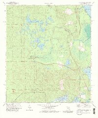
1972 Map of Juniper Springs
USGS Topo · Published 1987About this map
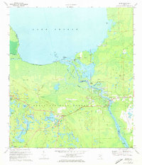
Juniper Springs Recreation Area and Fern Hammock Springs Campgrounds sit at the heart of this central Florida landscape, highlighting a region defined by its remarkable hydrologic features. The area is characterized by a dense network of freshwater springs and prairies, including Sweetwater Springs and the expansive Juniper Prairie. These water sources feed into Juniper Creek and Morman Branch, eventually reaching the shore of Lake George at the northeastern corner of the map.
Find a feature on this map
26 named features on this map. Tap any name to fly to it.
Don’t see what you’re looking for? This feature index may not catch every label — zoom into the map to look around manually.
Map Details
Editions of this 1972 Juniper Springs Map
3 editions found
Other maps of this area

1954 · Daytona Beach
USGS Topo · 1:250,000

1958 · Daytona Beach
USGS Topo · 1:250,000

1964 · Daytona Beach
USGS Topo · 1:250,000

1970 · Welaka SE
USGS Topo · 1:24,000

1970 · Salt Springs
USGS Topo · 1:24,000

1970 · Halfmoon Lake
USGS Topo · 1:24,000
1970 · Lake Kerr
USGS Topo · 1:24,000

1972 · Juniper Springs
USGS Topo · 1:24,000
1972 · Farles Lake
USGS Topo · 1:24,000
1972 · Astor
USGS Topo · 1:24,000