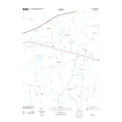
2013 Map of Juno
USGS Topo · Published 2013About this map
The Middle Fork Forked Deer River and the N Fork Forked Deer River dominate the drainage of this West Tennessee landscape, where small agricultural communities are linked by a network of rural roads. Central to the area is Spring Hill, situated near the headwaters of Courtney Br. To the north, the settlement of Independence sits near the crossing of Law Rd and Gurley Creek Rd, while Blue Goose and Juno occupy higher ground along the primary east-west corridor. The terrain is marked by numerous small tributaries such as Spencer Cr, McHaney Br, and Dry Br, which create a complex system of creek bottoms and low ridges. This 2013 survey provides a detailed view of the rural infrastructure, including many family-named roads like Beulah Holmes Rd and McDonald Rd that suggest long-standing local land ownership patterns.
Find a feature on this map
92 named features on this map. Tap any name to fly to it.
Don’t see what you’re looking for? This feature index may not catch every label — zoom into the map to look around manually.
Map Details
Editions of this 2013 Juno Map
This is the sole edition of this map. No revisions or reprints were ever made.
Other maps of this area

1936 · Clarksburg
USGS Topo · 1:24,000

1936 · Lexington
USGS Topo · 1:24,000

1936 · Life
USGS Topo · 1:24,000

1950 · Life
USGS Topo · 1:24,000

1950 · Lexington
USGS Topo · 1:24,000

1950 · Clarksburg
USGS Topo · 1:24,000

1953 · Claybrook
USGS Topo · 1:24,000

1953 · Beech Bluff
USGS Topo · 1:24,000

1955 · Luray
USGS Topo · 1:24,000

1955 · Juno
USGS Topo · 1:24,000