
1950 Map of Clarksburg
USGS Topo · Published 1953About this map
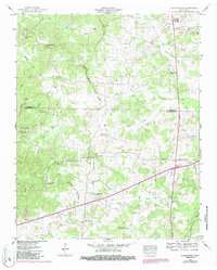
The Tennessee Valley Divide cuts through this landscape, marking a significant hydrologic boundary between the watershed of the Obion River to the west and the Big Sandy River system to the east. At the start of the 1950s, this portion of West Tennessee was defined by its network of agricultural crossroads and rural institutions. Significant drainage engineering is evident in the straight channels of the Roan Creek Drainage Canal and the Big Beaver Creek Drainage Canal, projects designed to manage the bottomlands of the local river forks. Rural life is anchored by a high density of neighborhood landmarks, including Hickory Plains Church, Parkers Chapel School, and the junction at Parker Crossroads. The Nashville Chattanooga and St Louis railway skirts the eastern edge of the survey, while the boundary between Carroll and Henderson Counties bisects the southern half of the map.
Find a feature on this map
53 named features on this map. Tap any name to fly to it.
Don’t see what you’re looking for? This feature index may not catch every label — zoom into the map to look around manually.
Map Details
Editions of this 1950 Clarksburg Map
2 editions found
Other maps of this area

1936 · Clarksburg
USGS Topo · 1:24,000

1936 · Lexington
USGS Topo · 1:24,000

1936 · Yuma
USGS Topo · 1:24,000

1936 · Center Ridge
USGS Topo · 1:24,000

1936 · Buena Vista
USGS Topo · 1:24,000

1936 · Chesterfield
USGS Topo · 1:24,000

1950 · Yuma
USGS Topo · 1:24,000

1950 · Palmer Shelter
USGS Topo · 1:24,000

1950 · Lexington
USGS Topo · 1:24,000
1950 · Chesterfield
USGS Topo · 1:24,000