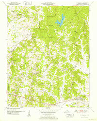
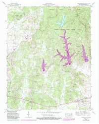
1950 Map of Chesterfield
USGS Topo · Published 1953About this map
Natchez Trace State Park and Forest dominates the landscape of eastern Henderson County, with the historic Natchez Trace cutting through the center of this 1950s survey. The rural character of the region is defined by a dense network of small family cemeteries and country institutions, including Bible Grove Ch, Maya Chapel, and the Howard Sch. In the southern portion of the map, the village of Chesterfield sits near a Dismantled RR, indicating a shift away from earlier rail-based commerce toward a road-and-forest economy.
Find a feature on this map
63 named features on this map. Tap any name to fly to it.
Don’t see what you’re looking for? This feature index may not catch every label — zoom into the map to look around manually.
Map Details
Editions of this 1950 Chesterfield Map
5 editions found
Other maps of this area

1936 · Clarksburg
USGS Topo · 1:24,000

1936 · Lexington
USGS Topo · 1:24,000

1936 · Yuma
USGS Topo · 1:24,000

1936 · Scotts Hill
USGS Topo · 1:24,000

1936 · Parsons
USGS Topo · 1:24,000

1936 · Reagan
USGS Topo · 1:24,000

1936 · Cavvia
USGS Topo · 1:24,000

1936 · Life
USGS Topo · 1:24,000

1936 · Chesterfield
USGS Topo · 1:24,000

1950 · Reagan
USGS Topo · 1:24,000