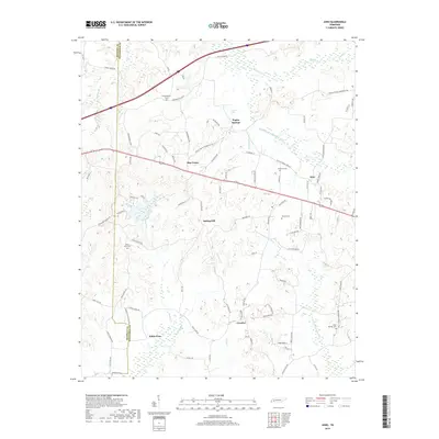
2019 Map of Juno
USGS Topo · Published 2019About this map
Blue Goose and Juno anchor the eastern landscape of the Madison and Henderson county line, where the terrain is defined by the branching waters of the Middle Fork Forked Deer River and its northern fork. This 2019 survey illustrates a predominantly rural Tennessee landscape where modern road networks follow the contours of old property lines and natural drainages. Small settlements like Crucifer, Spring Hill, and White Fern appear as distinct clusters among a network of family-named roads such as Ayers Rd and Ballard Rd. For those tracing local heritage, the map identifies several burial grounds including Union Grove Cem, Holly Springs Cem, and Independence Cem. The map's detail provides a clear view of the persistent rural character and agricultural layout of this West Tennessee region in the early 21st century.
Find a feature on this map
88 named features on this map. Tap any name to fly to it.
Don’t see what you’re looking for? This feature index may not catch every label — zoom into the map to look around manually.
Map Details
Editions of this 2019 Juno Map
This is the sole edition of this map. No revisions or reprints were ever made.
Other maps of this area

1936 · Clarksburg
USGS Topo · 1:24,000

1936 · Lexington
USGS Topo · 1:24,000

1936 · Life
USGS Topo · 1:24,000

1950 · Life
USGS Topo · 1:24,000

1950 · Lexington
USGS Topo · 1:24,000

1950 · Clarksburg
USGS Topo · 1:24,000

1953 · Claybrook
USGS Topo · 1:24,000

1953 · Beech Bluff
USGS Topo · 1:24,000

1955 · Luray
USGS Topo · 1:24,000

1955 · Juno
USGS Topo · 1:24,000