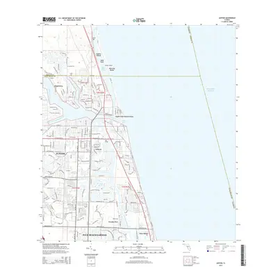
2015 Map of Jupiter
USGS Topo · Published 2015About this map
The Loxahatchee River dominates this coastal landscape, branching into the North Fork Loxahatchee River and Southwest Fork Loxahatchee River as it meets the sea at Jupiter Inlet. This modern survey illustrates the dense residential and recreational development of the northern Palm Beach shoreline, where established communities like Jupiter, Tequesta, and Juno Beach are interconnected by the Intracoastal Waterway. The presence of the Fec railroad and major crossings like the Jupiter Federal Bridge and 706 Bridge highlight the infrastructure required for this high-density corridor.
Find a feature on this map
171 named features on this map. Tap any name to fly to it.
Don’t see what you’re looking for? This feature index may not catch every label — zoom into the map to look around manually.
Map Details
Editions of this 2015 Jupiter Map
This is the sole edition of this map. No revisions or reprints were ever made.
Other maps of this area

1945 · Delta
USGS Topo · 1:24,000

1946 · Riviera Beach
USGS Topo · 1:24,000

1948 · Rood
USGS Topo · 1:24,000

1948 · Gomez
USGS Topo · 1:24,000

1948 · Hobe Sound
USGS Topo · 1:24,000

1948 · Jupiter
USGS Topo · 1:24,000

1949 · Rood
USGS Topo · 1:24,000

1949 · Gomez
USGS Topo · 1:24,000

1949 · Riviera Beach
USGS Topo · 1:24,000

1949 · Hobe Sound
USGS Topo · 1:24,000