2024 Map of Jupiter
USGS Topo · Published 2024About this map
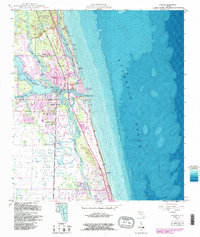
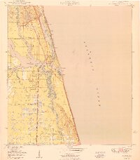
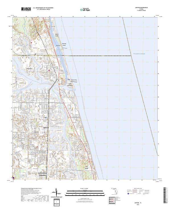
Jupiter and its surrounding coastal communities are defined by the convergence of the Loxahatchee River and the Atlantic Ocean at the Jupiter Inlet. This modern survey illustrates the dense residential development and intricate canal systems that characterize the northern Palm Beach coast, including Tequesta and the Jupiter Inlet Colony. The landscape is bisected by the Intracoastal Waterway, which separates the mainland from the barrier island environments of Jupiter Island and the Hobe Sound National Wildlife Refuge. Conservation areas and landmarks like Blowing Rocks and Hell Gate stand alongside modern infrastructure such as Jupiter Hospital and major thoroughfares like W Indian Town Rd and Donald Ross Rd. The map also traces the Florida Circumnavigational Paddling Trl, highlighting the region's enduring connection to its waterways and the preservation of natural corridors amidst suburban expansion.
Find a feature on this map
28 named features on this map. Tap any name to fly to it.
Don’t see what you’re looking for? This feature index may not catch every label — zoom into the map to look around manually.
Map Details
Editions of this 2024 Jupiter Map
This is the sole edition of this map. No revisions or reprints were ever made.
Historical Maps of Paradise Port Through Time
3 maps found