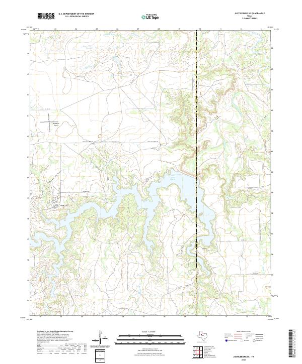
2022 Map of Justiceburg SE
USGS Topo · Published 2022About this map
Lake Alan Henry dominates this portion of the West Texas landscape along the border of Garza and Kent counties, its intricate shoreline reaching into numerous canyons and draws. The reservoir, formed along the Double Mountain Fork Brazos River, is surrounded by a network of local roads and developing residential pockets like Oak Canyon Ests and Cedar Hill. To the west, the topography transitions toward the high plains, where the Roy Ranch Airport sits as a notable landmark amidst the ranching country.
Find a feature on this map
31 named features on this map. Tap any name to fly to it.
Don’t see what you’re looking for? This feature index may not catch every label — zoom into the map to look around manually.
Map Details
Editions of this 2022 Justiceburg SE Map
This is the sole edition of this map. No revisions or reprints were ever made.
Other maps of this area

1954 · Lubbock
USGS Topo · 1:250,000

1954 · Big Spring
USGS Topo · 1:250,000

1958 · Big Spring
USGS Topo · 1:250,000

1969 · Cottonwood Creek
USGS Topo · 1:24,000

1969 · Justiceburg SE
USGS Topo · 1:24,000

1969 · Fluvanna
USGS Topo · 1:24,000
1969 · Justiceburg NW
USGS Topo · 1:24,000

1969 · Justiceburg
USGS Topo · 1:24,000

1969 · T-O Creek
USGS Topo · 1:24,000

1969 · Flat Top Mountain
USGS Topo · 1:24,000