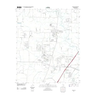
2013 Map of Justin
USGS Topo · Published 2013About this map
Justin stands as the primary hub of this North Texas landscape, where modern aviation and historical crossroads intersect just north of the Fort Worth Alliance Airport. The map highlights a significant density of private airfields, including Sitton Field Airport, Propwash Airport, and Flying S Farm Airport, illustrating the region's strong ties to civil aviation. To the south, the legacy of earlier settlement is preserved at Elizabethtown and the nearby Elizabethtown Cem, situated along the banks of Elizabeth Creek. The drainage patterns of Denton Creek, Harriet Creek, and Catherine Branch define the local topography, which is increasingly shaped by residential developments and the expansion of the regional transportation network. The proximity of the major airport hub suggests the rapid transition of this area from rural prairie into an integrated part of the metropolitan periphery.
Find a feature on this map
179 named features on this map. Tap any name to fly to it.
Don’t see what you’re looking for? This feature index may not catch every label — zoom into the map to look around manually.
Map Details
Editions of this 2013 Justin Map
This is the sole edition of this map. No revisions or reprints were ever made.
Other maps of this area

1894 · Fort Worth
USGS Topo · 1:125,000

1931 · Grapevine
USGS Topo · 1:62,500

1954 · Dallas
USGS Topo · 1:250,000

1954 · Sherman
USGS Topo · 1:250,000

1955 · Avondale
USGS Topo · 1:24,000

1955 · Keller
USGS Topo · 1:24,000

1955 · Haltom City
USGS Topo · 1:62,500

1958 · Dallas
USGS Topo · 1:250,000

1958 · Sherman
USGS Topo · 1:250,000
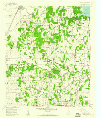
1959 · Colleyville
USGS Topo · 1:24,000