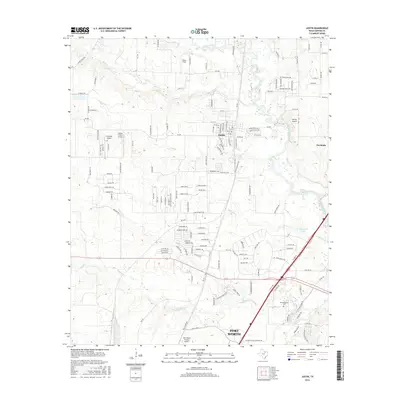
2016 Map of Justin
USGS Topo · Published 2016About this map
Justin stands as a central community within this North Texas landscape, where suburban expansion meets a deep-rooted aviation and agricultural history. The area is notable for its numerous private airstrips and larger facilities, ranging from the small Propwash Airport and Sitton Field to the industrial-scale Fort Worth Alliance Airport in the south. The terrain is defined by a series of waterways, including Denton Creek and its many tributaries like Elizabeth Cr and Oliver Cr, which historically dictated the placement of roads and early homesteads. For those tracing family history, the Justin Cemetery and the Elizabethtown Cem offer vital links to the pioneers who settled this portion of Denton County. The transition from rural acreage to residential development is evident in the burgeoning street networks around Northlake and the presence of Hatfield Elementary.
Find a feature on this map
154 named features on this map. Tap any name to fly to it.
Don’t see what you’re looking for? This feature index may not catch every label — zoom into the map to look around manually.
Map Details
Editions of this 2016 Justin Map
This is the sole edition of this map. No revisions or reprints were ever made.
Other maps of this area

1894 · Fort Worth
USGS Topo · 1:125,000

1931 · Grapevine
USGS Topo · 1:62,500

1954 · Dallas
USGS Topo · 1:250,000

1954 · Sherman
USGS Topo · 1:250,000

1955 · Avondale
USGS Topo · 1:24,000

1955 · Keller
USGS Topo · 1:24,000

1955 · Haltom City
USGS Topo · 1:62,500

1958 · Dallas
USGS Topo · 1:250,000

1958 · Sherman
USGS Topo · 1:250,000
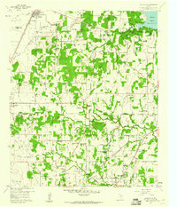
1959 · Colleyville
USGS Topo · 1:24,000