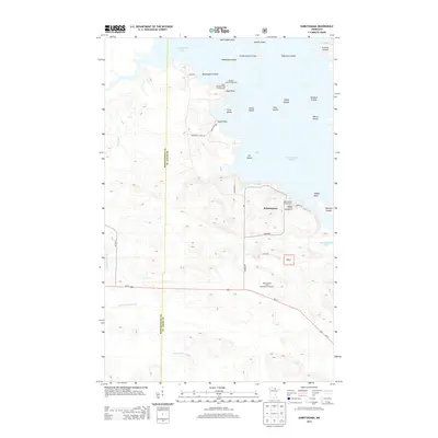
2013 Map of Kabetogama
USGS Topo · Published 2013About this map
Kabetogama Lake dominates this northern Minnesota landscape, where an intricate network of islands and points defines the shoreline. The settlement of Kabetogama serves as a central hub near the water, supported by several public access areas including the Kabetogama Campground and Gappas Landing Campground. This 2013 survey illustrates the area’s importance for recreation and navigation within the SNF, featuring numerous named landforms such as Bittersweet Island, Shipwreck Island, and the Sphunge Islands. Inland, the terrain is shaped by the winding E Br Rat Root River and Tom Cod Cr, while the boundary between Koochiching and St. Louis counties bisects the western portion of the map. Local travel is facilitated by corridors like Us-53 and Northern Lights Rd, connecting the lakefront to the Kabetogama Lake Information Wayside.
Find a feature on this map
39 named features on this map. Tap any name to fly to it.
Don’t see what you’re looking for? This feature index may not catch every label — zoom into the map to look around manually.
Map Details
Editions of this 2013 Kabetogama Map
This is the sole edition of this map. No revisions or reprints were ever made.
Other maps of this area

1954 · International Falls
USGS Topo · 1:250,000

1957 · International Falls
USGS Topo · 1:250,000

1958 · International Falls
USGS Topo · 1:250,000

1968 · Soldier Point
USGS Topo · 1:24,000

1968 · Daley Bay
USGS Topo · 1:24,000

1968 · Ash River SW
USGS Topo · 1:24,000

1969 · Ray SE
USGS Topo · 1:24,000

1969 · Island View
USGS Topo · 1:24,000

1969 · Ray
USGS Topo · 1:24,000

1969 · Ray SW
USGS Topo · 1:24,000