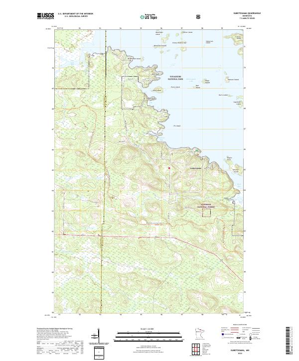
2022 Map of Kabetogama
USGS Topo · Published 2022About this map
The waters of Kabetogama Lake dominate the northern landscape of this 2022 survey, illustrating the complex shoreline and archipelago of Voyageurs National Park. The settlement of Kabetogama serves as a terrestrial anchor near the center of the map, connected by a network of local roads such as Co Hwy 122 and Burma Rd. The terrain is defined by a dense mosaic of wetlands and timberland, split between the national park and the Superior National Forest.
Find a feature on this map
46 named features on this map. Tap any name to fly to it.
Don’t see what you’re looking for? This feature index may not catch every label — zoom into the map to look around manually.
Map Details
Editions of this 2022 Kabetogama Map
This is the sole edition of this map. No revisions or reprints were ever made.
Other maps of this area

1954 · International Falls
USGS Topo · 1:250,000

1957 · International Falls
USGS Topo · 1:250,000

1958 · International Falls
USGS Topo · 1:250,000

1968 · Soldier Point
USGS Topo · 1:24,000

1968 · Daley Bay
USGS Topo · 1:24,000

1968 · Ash River SW
USGS Topo · 1:24,000

1969 · Ray SE
USGS Topo · 1:24,000

1969 · Island View
USGS Topo · 1:24,000

1969 · Ray
USGS Topo · 1:24,000

1969 · Ray SW
USGS Topo · 1:24,000