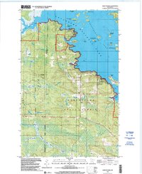
1999 Map of Kabetogama
USGS Topo · Published 2003About this map
Kabetogama serves as a central gateway to the sprawling water-and-island landscape of Voyageurs National Park at the close of the twentieth century. This survey documents the transition from the protected waters of Kabetogama Lake to the dense woods of the Kabetogama State Forest, where the Koochiching Co - St Louis Co line runs through a network of timberlands and seasonal paths. Local gathering places like Kabetogama Ch and the St Jude Chapel anchor the small lakeshore community, while the Wooden Frog Campground and the Kabetogama Lake Visitor Center indicate the importance of the regional recreation economy.
Find a feature on this map
39 named features on this map. Tap any name to fly to it.
Don’t see what you’re looking for? This feature index may not catch every label — zoom into the map to look around manually.
Map Details
Editions of this 1999 Kabetogama Map
This is the sole edition of this map. No revisions or reprints were ever made.
Other maps of this area

1954 · International Falls
USGS Topo · 1:250,000

1957 · International Falls
USGS Topo · 1:250,000

1958 · International Falls
USGS Topo · 1:250,000

1968 · Soldier Point
USGS Topo · 1:24,000

1968 · Daley Bay
USGS Topo · 1:24,000

1968 · Ash River SW
USGS Topo · 1:24,000

1969 · Ray SE
USGS Topo · 1:24,000

1969 · Island View
USGS Topo · 1:24,000

1969 · Ray
USGS Topo · 1:24,000

1969 · Ray SW
USGS Topo · 1:24,000