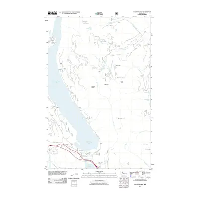
2011 Map of Kachess Lake
USGS Topo · Published 2011About this map
Kachess Dam and the waters of Little Kachess Lake dominate this high-elevation landscape, where the Kachess River flows south toward Lake Easton. This region of the Wenatchee National Forest is marked by complex water management and recreational infrastructure, including Forest Camp Kachess and the Kachess Campground. The topography is defined by prominent peaks such as Thorp Mountain and Frenchman Mountain, with the Thorp Mountain Lookout providing a high-point vantage over the Thorp Lake basin.
Find a feature on this map
40 named features on this map. Tap any name to fly to it.
Don’t see what you’re looking for? This feature index may not catch every label — zoom into the map to look around manually.
Map Details
Editions of this 2011 Kachess Lake Map
This is the sole edition of this map. No revisions or reprints were ever made.
Other maps of this area

1901 · Snoqualmie Pass
USGS Topo · 1:125,000

1903 · Snoqualmie
USGS Topo · 1:125,000

1957 · Wenatchee
USGS Topo · 1:250,000

1961 · Snoqualmie Pass
USGS Topo · 1:62,500

1961 · Easton
USGS Topo · 1:62,500

1961 · Kachess Lake
USGS Topo · 1:62,500

1962 · Lester
USGS Topo · 1:62,500

1975 · Snoqualmie Pass
USGS Topo · 1:100,000

1989 · Easton
USGS Topo · 1:24,000
1989 · Ronald
USGS Topo · 1:24,000