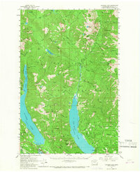
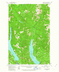
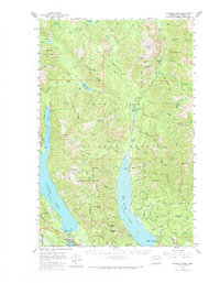
1961 Map of Kachess Lake
USGS Topo · Published 1967About this map
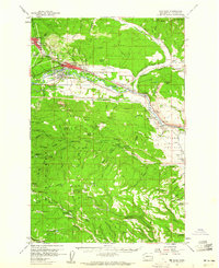
The Kachess Dam and the emerging recreation corridor along the Cle Elum River define this 1961 field-checked survey of the Kittitas County highlands. The settlement of Easton serves as a focal point near the southern boundary, where the Easton Airstrip and Lake Easton State Park sit adjacent to the rail lines. This era represents a period of transitioning land use within the Wenatchee National Forest, where resource extraction at the Elsnor Mine and Sting Mine coexists with a growing network of Forest Service infrastructure, including the Salmon la Sac Guard Sta.
Find a feature on this map
100 named features on this map. Tap any name to fly to it.
Don’t see what you’re looking for? This feature index may not catch every label — zoom into the map to look around manually.
Map Details
Editions of this 1961 Kachess Lake Map
3 editions found
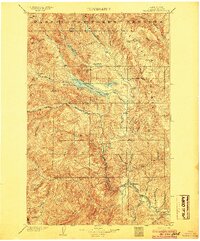
Other maps of this area

1897 · Mount Stuart
USGS Topo · 1:125,000

1901 · Chiwaukum
USGS Topo · 1:125,000

1901 · Snoqualmie Pass
USGS Topo · 1:125,000

1902 · Skykomish
USGS Topo · 1:125,000

1902 · Mount Stuart
USGS Topo · 1:125,000

1903 · Snoqualmie
USGS Topo · 1:125,000
1904 · Chiwaukum
USGS Topo · 1:125,000

1905 · Skykomish
USGS Topo · 1:125,000

1957 · Wenatchee
USGS Topo · 1:250,000
1958 · Cle Elum
USGS Topo · 1:62,500