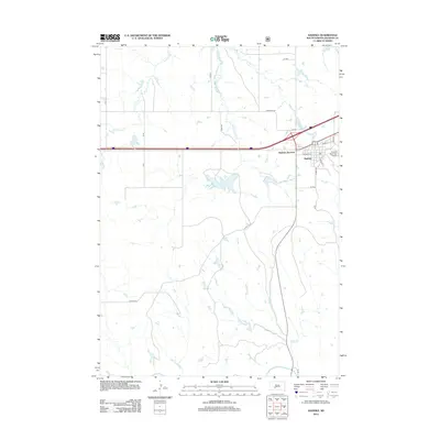
2012 Map of Kadoka
USGS Topo · Published 2012About this map
The town of Kadoka and its northern gateway at Kadoka Junction define this West River South Dakota landscape during the early 21st century. Situated in Jackson County, the community is anchored by infrastructure that supports its role as a regional hub, including the Kadoka Municipal Airport and a network of arterial roads like Main St S and W 2nd Ave. The surrounding prairie is drained by several watercourses that carve through the terrain, including Franklin Cr, White Willow Cr, and East Cr, all eventually contributing to the White River which flows along the southern edge of the survey area.
Find a feature on this map
25 named features on this map. Tap any name to fly to it.
Don’t see what you’re looking for? This feature index may not catch every label — zoom into the map to look around manually.
Map Details
Editions of this 2012 Kadoka Map
This is the sole edition of this map. No revisions or reprints were ever made.
Other maps of this area

1950 · Weta
USGS Topo · 1:24,000

1951 · Wanblee NW
USGS Topo · 1:24,000

1951 · Pass Creek NW
USGS Topo · 1:24,000

1951 · Kadoka
USGS Topo · 1:24,000

1951 · Belvidere SW
USGS Topo · 1:24,000

1951 · Wanblee NE
USGS Topo · 1:24,000

1953 · Philip Junction
USGS Topo · 1:24,000

1954 · Belvidere NW
USGS Topo · 1:24,000

1954 · Kadoka NE
USGS Topo · 1:24,000

1955 · Martin
USGS Topo · 1:250,000