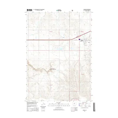
2015 Map of Kadoka
USGS Topo · Published 2015About this map
Kadoka and Kadoka Junction anchor the landscape on the edge of the Badlands, where the high plains meet the intricate drainages of the White River valley. This 2015 survey by the U.S. Geological Survey illustrates the transition from the structured residential grid of Kadoka—defined by local streets like Maple St and Sycamore St—to the vast open range of the Buffalo Gap National Grassland. The topography is shaped by the erosive forces of Franklin Cr and White Willow Cr, which carve through the terrain south toward the river. Transportation remains central to the area's identity, with modern Interstate 90 running parallel to historic routes like Hwy 16 and Sd Highway 248. North of the town center, Kadoka Lake provides a distinct water feature amidst the dry, undulating breaks of Jackson County.
Find a feature on this map
22 named features on this map. Tap any name to fly to it.
Don’t see what you’re looking for? This feature index may not catch every label — zoom into the map to look around manually.
Map Details
Editions of this 2015 Kadoka Map
This is the sole edition of this map. No revisions or reprints were ever made.
Other maps of this area

1950 · Weta
USGS Topo · 1:24,000

1951 · Wanblee NW
USGS Topo · 1:24,000

1951 · Pass Creek NW
USGS Topo · 1:24,000

1951 · Kadoka
USGS Topo · 1:24,000

1951 · Belvidere SW
USGS Topo · 1:24,000

1951 · Wanblee NE
USGS Topo · 1:24,000

1953 · Philip Junction
USGS Topo · 1:24,000

1954 · Belvidere NW
USGS Topo · 1:24,000

1954 · Kadoka NE
USGS Topo · 1:24,000

1955 · Martin
USGS Topo · 1:250,000