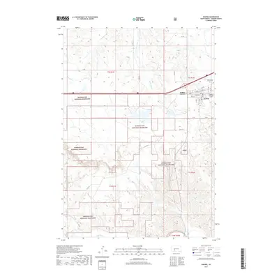
2017 Map of Kadoka
USGS Topo · Published 2017About this map
The town of Kadoka serves as a gateway to the surrounding prairie, situated at the intersection of modern transportation routes and ancestral watercourses. This 2017 study illustrates the community's layout, from the residential grid of streets like Maple St and Main St to the Kadoka Municipal Airport on the eastern edge. North of the town center lies the Kadoka Calvary - Fairview Cem, a vital site for genealogical research in Jackson County.
Find a feature on this map
42 named features on this map. Tap any name to fly to it.
Don’t see what you’re looking for? This feature index may not catch every label — zoom into the map to look around manually.
Map Details
Editions of this 2017 Kadoka Map
This is the sole edition of this map. No revisions or reprints were ever made.
Other maps of this area

1950 · Weta
USGS Topo · 1:24,000

1951 · Wanblee NW
USGS Topo · 1:24,000

1951 · Pass Creek NW
USGS Topo · 1:24,000

1951 · Kadoka
USGS Topo · 1:24,000

1951 · Belvidere SW
USGS Topo · 1:24,000

1951 · Wanblee NE
USGS Topo · 1:24,000

1953 · Philip Junction
USGS Topo · 1:24,000

1954 · Belvidere NW
USGS Topo · 1:24,000

1954 · Kadoka NE
USGS Topo · 1:24,000

1955 · Martin
USGS Topo · 1:250,000