2021 Map of Kadoka
USGS Topo · Published 2021About this map
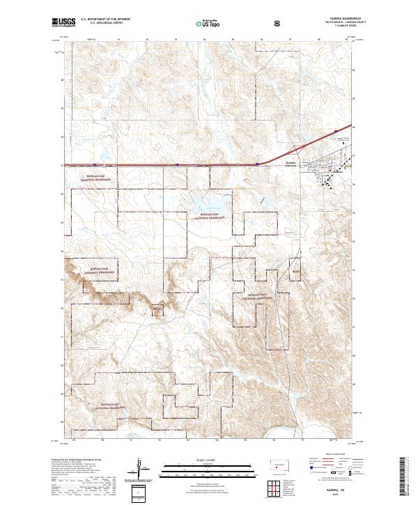
The Jackson County Courthouse serves as a central anchor for the town of Kadoka, situated just south of the junction with Interstate 90. This 2021 survey illustrates a community defined by its proximity to the wide expanses of the Buffalo Gap National Grassland, which surrounds the township on multiple sides. Local geography is shaped by watercourses such as White Willow Creek and Franklin Creek, which flow through the undulating landscape toward the White River at the southern edge of the quadrangle. North of the main settlement, the Kadoka Calvary - Fairview Cemetery and the waters of Kadoka Lake mark the transition between the developed grid of the town and the open prairie. The map details a network of rural routes, including County Road CH 5 and County Road CH 6, which connect remote ranching and grassland areas to the regional hub at Kadoka Junction.
Find a feature on this map
40 named features on this map. Tap any name to fly to it.
Don’t see what you’re looking for? This feature index may not catch every label — zoom into the map to look around manually.
Map Details
Editions of this 2021 Kadoka Map
This is the sole edition of this map. No revisions or reprints were ever made.