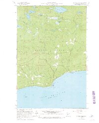
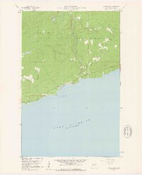
1960 Map of Kadunce Creek
USGS Topo · Published 1967About this map
Kadunce Creek State Park and the rugged northern shoreline of Lake Superior anchor this mid-century survey of the Minnesota Arrowhead region. The landscape is defined by the sharp descent from the Superior National Forest down to the water, notably marked by the Cliff and Red Cliff formations. The drainage pattern of Kadunce Creek and Kimball Creek is clearly mapped as they cut through the timbered highlands towards the lake. Interior water bodies like Trout Lake, Mink Lake, and Kimball Lake are shown with surrounding features such as a Campground and several Gravel Pit sites, reflecting the area's dual character as a recreational destination and a source of road-building materials. A section of road marked Under Construction during the late 1950s field checks illustrates the developing transportation network along the North Shore.
Find a feature on this map
22 named features on this map. Tap any name to fly to it.
Don’t see what you’re looking for? This feature index may not catch every label — zoom into the map to look around manually.
Map Details
Editions of this 1960 Kadunce Creek Map
4 editions found
Other maps of this area

1919 · Grand Marais
USGS Topo · 1:62,500

1954 · Two Harbors
USGS Topo · 1:250,000

1957 · Two Harbors
USGS Topo · 1:250,000

1958 · Two Harbors
USGS Topo · 1:250,000

1959 · Northern Light Lake
USGS Topo · 1:24,000

1959 · Pine Mountain
USGS Topo · 1:24,000

1959 · Tom Lake
USGS Topo · 1:24,000

1960 · Grand Marais
USGS Topo · 1:24,000
1960 · Kadunce Creek
USGS Topo · 1:24,000
1960 · Marr Island
USGS Topo · 1:24,000