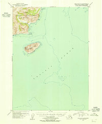
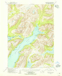
1954 Map of Kaguyak D-5
USGS Topo · Published 1955About this map
Kodiak Island meets the expanse of the Pacific Ocean in this mid-century survey of the island's southeastern reaches. The coastline is defined by prominent maritime landmarks such as Cape Kiavak and the sheltered waters of Knoll Bay, which sits just north of Knoll Point. This coastal landscape is largely preserved within the Kodiak National Wildlife Refuge, indicating the area's significance for conservation and wildlife habitat during the 1950s.
Find a feature on this map
8 named features on this map. Tap any name to fly to it.
Don’t see what you’re looking for? This feature index may not catch every label — zoom into the map to look around manually.
Map Details
Editions of this 1954 Kaguyak D-5 Map
This is the sole edition of this map. No revisions or reprints were ever made.
Other maps of this area

1951 · Kaguyak
USGS Topo · 1:250,000

1952 · Kodiak
USGS Topo · 1:250,000

1952 · Kaguyak
USGS Topo · 1:250,000

1952 · Kaguyak D-5
USGS Topo · 1:63,360

1952 · Kaguyak D-6
USGS Topo · 1:63,360

1952 · Kodiak A-6
USGS Topo · 1:63,360
1952 · Kodiak A-5
USGS Topo · 1:63,360
1952 · Kodiak A-4
USGS Topo · 1:63,360
1954 · Kodiak A-4
USGS Topo · 1:63,360
1954 · Kodiak A-6
USGS Topo · 1:63,360