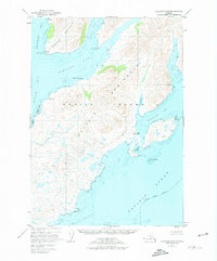
1952 Map of Kaguyak D-6
USGS Topo · Published 1974About this map
Kodiak Island's southern coastline, within the Kodiak National Wildlife Refuge, reveals an intricate network of deep-water fjords and points in the early 1950s. The settlement at Kaguyak sits on the shore of Kaguyak Bay, protected by the massive Peninsula landform that separates it from Jap Bay to the north. This survey illustrates a landscape defined by maritime proximity, where remote outposts like Cabin and Bluff provide the only signs of human habitation amidst the steep terrain of the Hepburn Peninsula and Alulik.
Find a feature on this map
26 named features on this map. Tap any name to fly to it.
Don’t see what you’re looking for? This feature index may not catch every label — zoom into the map to look around manually.
Map Details
Editions of this 1952 Kaguyak D-6 Map
2 editions found
Other maps of this area

1951 · Kaguyak
USGS Topo · 1:250,000

1951 · Trinity Islands
USGS Topo · 1:250,000

1951 · Karluk
USGS Topo · 1:250,000

1952 · Kodiak
USGS Topo · 1:250,000

1952 · Kaguyak
USGS Topo · 1:250,000

1952 · Karluk
USGS Topo · 1:250,000

1952 · Kaguyak D-5
USGS Topo · 1:63,360

1952 · Trinity Islands D-1
USGS Topo · 1:63,360

1952 · Karluk A-1
USGS Topo · 1:63,360

1952 · Kaguyak D-6
USGS Topo · 1:63,360