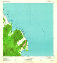
1954 Map of Kahana
USGS Topo · Published 1965About this map
Kamehameha Highway traces the windward shoreline of Oahu in this mid-century survey, linking the small communities of Kahana and Kaaawa against the backdrop of the Hauula Forest Reserve. The map details a transition from coastal habitation to the steep interiors of the Kaaawa Forest Reserve and Waihole Forest Reserve, where a foot trail and the Kahana Trail provide access to the ridge lines.
Find a feature on this map
40 named features on this map. Tap any name to fly to it.
Don’t see what you’re looking for? This feature index may not catch every label — zoom into the map to look around manually.
Map Details
Editions of this 1954 Kahana Map
2 editions found
Other maps of this area

1952 · Mokapu
USGS Topo · 1:24,000

1953 · Hauula
USGS Topo · 1:24,000

1954 · Oahu
USGS Topo · 1:250,000

1954 · Kahuku
USGS Topo · 1:24,000

1954 · Kahana
USGS Topo · 1:24,000

1954 · Kaneohe
USGS Topo · 1:24,000

1954 · Waipahu
USGS Topo · 1:24,000

1959 · Mokapu
USGS Topo · 1:24,000

1959 · Kaneohe
USGS Topo · 1:24,000

1959 · Waipahu
USGS Topo · 1:24,000