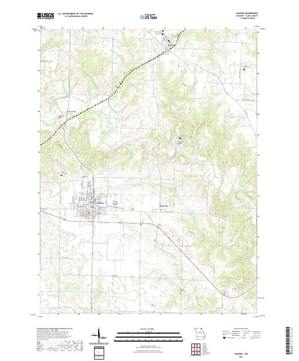
2021 Map of Kahoka
USGS Topo · Published 2021About this map
The Clark County Courthouse serves as the focal point for Kahoka, Missouri, where a dense grid of streets like W Main St and N Jefferson St radiates from the town center. This northeastern Missouri landscape is defined by the winding paths of the Fox River and Little Fox River, which are spanned by several named crossings including Sherwood Bridge and Waterloo Bridge. The map reveals a deeply rooted rural community, marked by numerous family and community burial grounds such as Saint Paul Cem, Prairie Church Cem, and Northrup Cem. To the east, the small settlement of Clark City sits near the base of Trump Ridge, while the village of Revere occupies the northern reaches. The presence of the Kahoka Municipal Airport and the Number 14 Reservoir indicates the modern infrastructure supporting this agricultural region.
Find a feature on this map
55 named features on this map. Tap any name to fly to it.
Don’t see what you’re looking for? This feature index may not catch every label — zoom into the map to look around manually.
Map Details
Editions of this 2021 Kahoka Map
This is the sole edition of this map. No revisions or reprints were ever made.
Other maps of this area

1903 · Kahoka
USGS Topo · 1:125,000

1949 · Wayland
USGS Topo · 1:24,000

1949 · Kahoka SE
USGS Topo · 1:24,000

1949 · Kahoka
USGS Topo · 1:24,000

1949 · St. Patrick
USGS Topo · 1:24,000

1950 · Kahoka
USGS Topo · 1:24,000

1950 · Saint Patrick
USGS Topo · 1:24,000

1950 · Kahoka SE
USGS Topo · 1:24,000

1950 · Wayland
USGS Topo · 1:24,000

1950 · Neeper
USGS Topo · 1:24,000