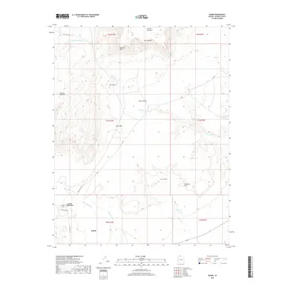
2018 Map of Kaibab
USGS Topo · Published 2018About this map
Indian Moccasin and Kaibab anchor the southwestern corner of this landscape, where the high plateaus of Mohave County meet a network of seasonal drainages and springs. The terrain is defined by dramatic escarpments, including the Vermilion Cliffs in the north and the Shinarump Cliffs to the southeast. Between these heights, the Sandy Canyon Wash and Sand Wash systems carve through the valley floor, supported by vital water sources like Point Spring, Aulson Spring, and Red Cliff Spring. This 2018 survey reveals a land shaped by geological layers and remote access, with Bia RD and Moccasin Wash RD providing the primary routes through the canyons. The presence of Cedar Ridge and the Blue Knolls offers distinct landmarks for those navigating the high desert environment between the Moccasin Mountains and the Moquith Mountains.
Find a feature on this map
33 named features on this map. Tap any name to fly to it.
Don’t see what you’re looking for? This feature index may not catch every label — zoom into the map to look around manually.
Map Details
Editions of this 2018 Kaibab Map
This is the sole edition of this map. No revisions or reprints were ever made.
Other maps of this area

1886 · Kanab
USGS Topo · 1:250,000

1886 · Kaibab
USGS Topo · 1:250,000

1953 · Cedar City
USGS Topo · 1:250,000

1953 · Grand Canyon
USGS Topo · 1:250,000

1954 · Kanab SW
USGS Topo · 1:24,000

1954 · Fredonia NW
USGS Topo · 1:24,000

1954 · Kanab SE
USGS Topo · 1:24,000

1954 · Short Creek SE
USGS Topo · 1:24,000

1954 · Fredonia SW
USGS Topo · 1:24,000

1954 · Fredonia NE
USGS Topo · 1:24,000