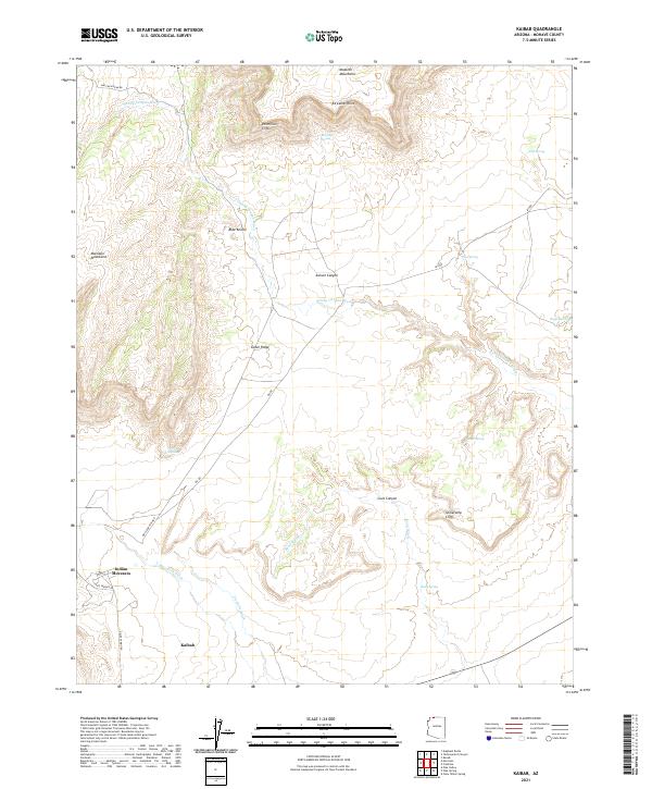
2021 Map of Kaibab
USGS Topo · Published 2021About this map
Kaibab and the settlement of Indian Moccasin anchor the southwestern corner of this landscape, situated near the transition from the Moccasin Mountains to the desert floor. The area is defined by massive topographic shifts, most notably the towering Vermilion Cliffs and Shinarump Cliffs that dominate the northern and central sections. Local hydrology is characterized by intermittent drainages such as Sandy Canyon Wash and Sand Wash, which weave through Aulson Canyon and Cove Canyon. These washes were critical for early navigation and land use in this arid region.
Find a feature on this map
33 named features on this map. Tap any name to fly to it.
Don’t see what you’re looking for? This feature index may not catch every label — zoom into the map to look around manually.
Map Details
Editions of this 2021 Kaibab Map
This is the sole edition of this map. No revisions or reprints were ever made.
Other maps of this area

1886 · Kanab
USGS Topo · 1:250,000

1886 · Kaibab
USGS Topo · 1:250,000

1953 · Cedar City
USGS Topo · 1:250,000

1953 · Grand Canyon
USGS Topo · 1:250,000

1954 · Kanab SW
USGS Topo · 1:24,000

1954 · Fredonia NW
USGS Topo · 1:24,000

1954 · Kanab SE
USGS Topo · 1:24,000

1954 · Short Creek SE
USGS Topo · 1:24,000

1954 · Fredonia SW
USGS Topo · 1:24,000

1954 · Fredonia NE
USGS Topo · 1:24,000