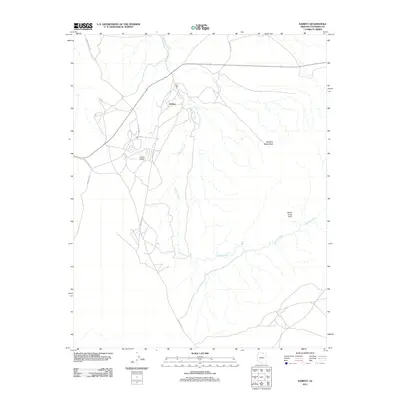
2011 Map of Kaibito
USGS Topo · Published 2011About this map
Kaibito serves as the central hub of this high-desert plateau landscape, where human activity is closely tied to scarce water sources like Kaibito Spring and Shonto Spring. The settlement pattern follows a network of tribal and local roads, including Bia Paved Rd and Indian Rte 21, which connect the community and the Kaibito Airport to the surrounding terrain. The landscape is defined by its drainage systems and natural landmarks, most notably the winding course of Kaibito Creek. This survey captures the region as it appeared in the early 21st century, illustrating the intersection of essential infrastructure and geological features. Prominent natural formations such as Whiskey Bottle Rock and White Craig Arch stand as distinctive navigational markers across the arid expanse, providing a sense of scale and orientation for those traveling the routes through this Coconino County terrain.
Find a feature on this map
11 named features on this map. Tap any name to fly to it.
Don’t see what you’re looking for? This feature index may not catch every label — zoom into the map to look around manually.
Map Details
Editions of this 2011 Kaibito Map
This is the sole edition of this map. No revisions or reprints were ever made.
Other maps of this area

1883 · Marsh Pass
USGS Topo · 1:250,000

1886 · Echo Cliffs
USGS Topo · 1:250,000

1891 · Echo Cliffs
USGS Topo · 1:250,000

1892 · Marsh Pass
USGS Topo · 1:250,000

1956 · Marble Canyon
USGS Topo · 1:250,000

1959 · Marble Canyon
USGS Topo · 1:250,000

1961 · Marble Canyon
USGS Topo · 1:250,000

1970 · Square Butte
USGS Topo · 1:24,000
1970 · Two Red Mesas
USGS Topo · 1:24,000
1970 · White Mesa Arch
USGS Topo · 1:24,000