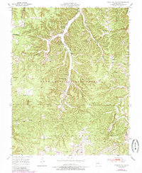
1950 Map of Kaintuck Hollow
USGS Topo · Published 1985About this map
Mill Creek and Kaintuck Hollow wind through this mid-century landscape in the Mark Twain National Forest. The map documents a rural community structure defined by its local institutions, including Mill Creek Church and its neighboring Mill Creek Cemetery. A high concentration of district schools, such as Yelton School, Colen School, and the already noted Western Star School (Abandoned), indicates the distribution of family farms across the townships of Liberty and Spring Creek.
Find a feature on this map
28 named features on this map. Tap any name to fly to it.
Don’t see what you’re looking for? This feature index may not catch every label — zoom into the map to look around manually.
Map Details
Editions of this 1950 Kaintuck Hollow Map
3 editions found
Other maps of this area

1912 · Rolla
USGS Topo · 1:62,500

1936 · Waynesville
USGS Topo · 1:48,000

1937 · Edgar Springs
USGS Topo · 1:48,000

1941 · Big Piney
USGS Topo · 1:62,500

1942 · Waynesville
USGS Topo · 1:62,500

1943 · Big Piney
USGS Topo · 1:62,500

1944 · Waynesville
USGS Topo · 1:62,500

1945 · Edgar Springs
USGS Topo · 1:62,500

1949 · Rolla
USGS Topo · 1:250,000

1950 · Newburg
USGS Topo · 1:24,000