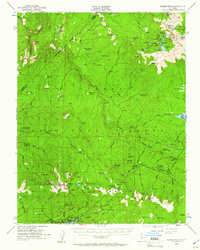
1953 Map of Kaiser Peak
USGS Topo · Published 1961About this map
Lakeshore sits at the southern edge of this high-elevation landscape, serving as a focal point for activity near the shore of Huntington Lake. The area is defined by the Sierra National Forest and the rugged drainage of the South Fork San Joaquin River. Traces of earlier development and administrative presence are visible through several remote outposts, including the Kaiser Diggings Guard Station and the High Sierra Ranger Sta. The map highlights a network of trails and roads, such as the Kaiser Pass Road, which provides access to the interior of the Silver Divide.
Find a feature on this map
122 named features on this map. Tap any name to fly to it.
Don’t see what you’re looking for? This feature index may not catch every label — zoom into the map to look around manually.
Map Details
Editions of this 1953 Kaiser Peak Map
5 editions found

Other maps of this area

1901 · Mt. Lyell
USGS Topo · 1:125,000

1904 · Kaiser
USGS Topo · 1:125,000

1912 · Mt. Goddard
USGS Topo · 1:125,000

1914 · Mt. Morrison
USGS Topo · 1:125,000

1947 · Mariposa
USGS Topo · 1:250,000

1948 · Mariposa
USGS Topo · 1:250,000

1953 · Mt. Morrison
USGS Topo · 1:62,500

1953 · Merced Peak
USGS Topo · 1:62,500

1953 · Mt Abbot
USGS Topo · 1:62,500

1953 · Devils Postpile
USGS Topo · 1:62,500