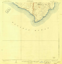
1924 Map of Kalae
USGS Topo · Published 1924About this map
Lava Flow of 1887 and the Lava Flow of 1868 dominate this southern Hawaiian coastline, illustrating the transformative power of volcanic activity during the late 19th century. Surveyed in 1921, the map captures a landscape defined by sharp topographical contrasts, from the sea-facing Pali Haukeuke cliffs to the varied cinder cones like Puu Maemae and Puu Hou.
Find a feature on this map
59 named features on this map. Tap any name to fly to it.
Don’t see what you’re looking for? This feature index may not catch every label — zoom into the map to look around manually.
Map Details
Editions of this 1924 Kalae Map
3 editions found
Other maps of this area

1924 · Kalae
USGS Topo · 1:62,500

1924 · Honuapo
USGS Topo · 1:62,500

1928 · Hoopuloa
USGS Topo · 1:62,500

1954 · Hawaii South
USGS Topo · 1:250,000

1959 · Hawaii South
USGS Topo · 1:250,000

1961 · Hawaii South
USGS Topo · 1:250,000

1962 · Hawaii South
USGS Topo · 1:250,000

1962 · Puu Hou
USGS Topo · 1:24,000

1962 · Kahuku Ranch
USGS Topo · 1:24,000

1962 · Pohue Bay
USGS Topo · 1:24,000