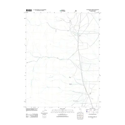
2012 Map of Kalamazoo Creek
USGS Topo · Published 2012About this map
Eldridge Ranch and Meadow Creek Ranch sit as established outposts in this high-desert landscape of White Pine County. The terrain is defined by a series of parallel watercourses and canyons descending from the west, including Kalamazoo Cr, Muncy Cr, and Meadow Cr. These drainage patterns, such as those through Fandango Canyon and Rams Horn Canyon, dictate the placement of the sparse road network, including the Natl Forest Develop Road 432 Rd.
Find a feature on this map
21 named features on this map. Tap any name to fly to it.
Don’t see what you’re looking for? This feature index may not catch every label — zoom into the map to look around manually.
Map Details
Editions of this 2012 Kalamazoo Creek Map
This is the sole edition of this map. No revisions or reprints were ever made.
Other maps of this area

1952 · Ely
USGS Topo · 1:125,000

1956 · Ely
USGS Topo · 1:250,000

1959 · Ely
USGS Topo · 1:250,000

1959 · Schell Peaks
USGS Topo · 1:62,500

1963 · Ely
USGS Topo · 1:250,000

1981 · North Schell Peak
USGS Topo · 1:24,000

1981 · Duck Creek Valley
USGS Topo · 1:24,000
1982 · Kalamazoo Creek
USGS Topo · 1:24,000
1982 · Silver Canyon
USGS Topo · 1:24,000
1982 · Mattier Creek
USGS Topo · 1:24,000