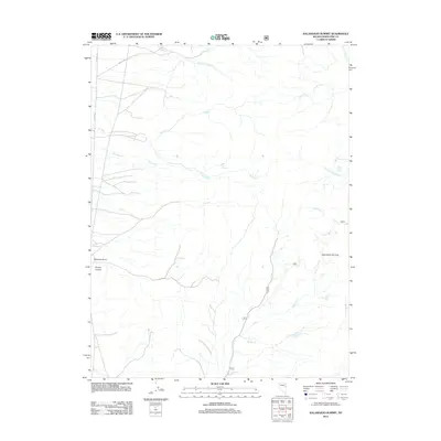
2012 Map of Kalamazoo Summit
USGS Topo · Published 2012About this map
Kalamazoo Summit serves as the high-point anchor for this landscape in White Pine County, where high-altitude drainages define the movement of water across the Great Basin. The hydrology is remarkably complex for an arid region, featuring a network of seasonal and perennial flows including Fitzhugh Cr and its southern fork, alongside the branching headwaters of Kalamazoo Cr and Middle Cr. These water sources were vital for early ranching and transit, noted by the presence of Oil Springs and the evocatively named Ice Cream Springs.
Find a feature on this map
21 named features on this map. Tap any name to fly to it.
Don’t see what you’re looking for? This feature index may not catch every label — zoom into the map to look around manually.
Map Details
Editions of this 2012 Kalamazoo Summit Map
This is the sole edition of this map. No revisions or reprints were ever made.
Other maps of this area

1952 · Ely
USGS Topo · 1:125,000

1956 · Ely
USGS Topo · 1:250,000

1958 · McGill
USGS Topo · 1:24,000

1958 · McGill
USGS Topo · 1:62,500

1959 · Ely
USGS Topo · 1:250,000

1959 · Schell Peaks
USGS Topo · 1:62,500

1963 · Ely
USGS Topo · 1:250,000

1981 · North Schell Peak
USGS Topo · 1:24,000

1981 · Duck Creek Valley
USGS Topo · 1:24,000
1982 · Kalamazoo Creek
USGS Topo · 1:24,000