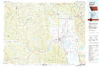
1981 Map of Kalispell
USGS Topo · Published 1982About this map
Kalispell serves as the focal point of this 1980s landscape, situated where the Stillwater River and Whitefish River converge to join the Flathead River. This era of the Flathead Valley shows a well-established transportation network, with Burlington Northern rail lines and federal highways connecting timber and recreation hubs. To the north, the waters of Whitefish Lake sit at the base of the Whitefish Range, while the vast Hungry Horse Reservoir dominates the eastern corridor near Martin City. The map documents the sprawling conservation and managed lands of the era, including the Stillwater Game Preserve and the boundaries of Glacier National Park. Significant local infrastructure is noted, from the Glacier Park Intl Airport to the Cheston National Fish Hatchery, reflecting the region's importance for both transit and natural resource management at the start of the 1980s.
Find a feature on this map
99 named features on this map. Tap any name to fly to it.
Don’t see what you’re looking for? This feature index may not catch every label — zoom into the map to look around manually.
Map Details
Editions of this 1981 Kalispell Map
This is the sole edition of this map. No revisions or reprints were ever made.
Other maps of this area

1904 · Chief Mountain
USGS Topo · 1:125,000

1906 · Kintla Lakes
USGS Topo · 1:125,000

1913 · Stryker
USGS Topo · 1:125,000

1914 · Nyack
USGS Topo · 1:125,000

1916 · Stryker
USGS Topo · 1:125,000

1920 · Flathead Lake
USGS Topo · 1:125,000

1920 · Jennings
USGS Topo · 1:125,000

1935 · Thompson Lakes
USGS Topo · 1:96,000

1937 · Thompson Falls
USGS Topo · 1:125,000

1938 · Chief Mountain
USGS Topo · 1:125,000