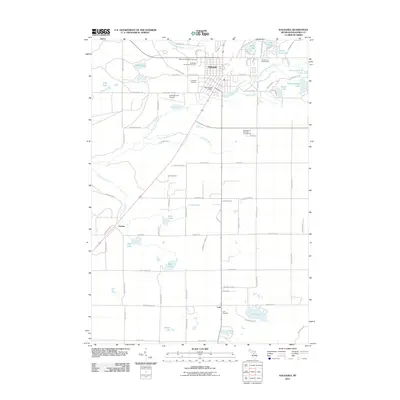
2011 Map of Kalkaska
USGS Topo · Published 2011About this map
Kalkaska serves as the central hub of this northern Michigan landscape, where the North Branch Boardman River and its numerous tributaries like Failing Creek and Crofton Creek carve through the glacial terrain. The village is well-established with civic landmarks such as the Kalkaska County Fairgrounds, the Kalkaska Post Office, and the Kaliseum Recreation Complex. To the south, smaller rural settlements like Crofton and Lodi maintain their identity along the primary north-south corridor of Old M 66.
Find a feature on this map
89 named features on this map. Tap any name to fly to it.
Don’t see what you’re looking for? This feature index may not catch every label — zoom into the map to look around manually.
Map Details
Editions of this 2011 Kalkaska Map
This is the sole edition of this map. No revisions or reprints were ever made.
Other maps of this area

1954 · Traverse City
USGS Topo · 1:250,000

1956 · Mancelona
USGS Topo · 1:62,500

1956 · Kalkaska
USGS Topo · 1:62,500

1956 · Fife Lake
USGS Topo · 1:62,500

1957 · Elk Rapids
USGS Topo · 1:62,500

1958 · Traverse City
USGS Topo · 1:250,000

1983 · Traverse City
USGS Topo · 1:100,000
1983 · Torch River
USGS Topo · 1:24,000
1985 · Kalkaska
USGS Topo · 1:24,000
1985 · Sharon
USGS Topo · 1:24,000