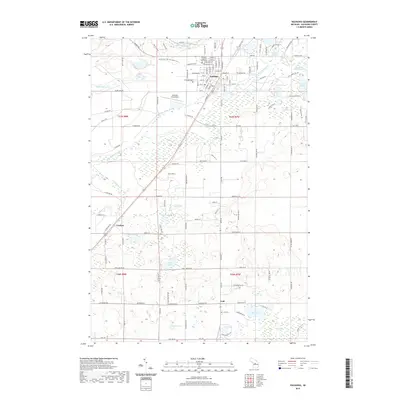
2019 Map of Kalkaska
USGS Topo · Published 2019About this map
Kalkaska serves as the focal point of this northern Michigan landscape, characterized by the convergence of the Little Rapid River and the upper reaches of the Boardman River. The settlement pattern follows a clear transition from the organized street grid of the village, anchored by the Kalkaska County Courthouse, to more dispersed rural clusters like Crofton and Lodi. The terrain is defined by a glacial legacy of kettle lakes and wetlands, including Crofton Swamp and East Lake Swamp, which separate the primary travel corridors from the surrounding woodlands. Transportation and recreation are interwoven throughout the area, with the N Country Trail; Iron Belle Trail providing a non-motorized path across the county, while the Kalkaska City Airport and state routes facilitate regional access. Smaller landmarks like Evergreen Cem and Lodi Cem offer precise points of interest for those tracing family history in the township.
Find a feature on this map
147 named features on this map. Tap any name to fly to it.
Don’t see what you’re looking for? This feature index may not catch every label — zoom into the map to look around manually.
Map Details
Editions of this 2019 Kalkaska Map
This is the sole edition of this map. No revisions or reprints were ever made.
Other maps of this area

1954 · Traverse City
USGS Topo · 1:250,000

1956 · Mancelona
USGS Topo · 1:62,500

1956 · Kalkaska
USGS Topo · 1:62,500

1956 · Fife Lake
USGS Topo · 1:62,500

1957 · Elk Rapids
USGS Topo · 1:62,500

1958 · Traverse City
USGS Topo · 1:250,000

1983 · Traverse City
USGS Topo · 1:100,000
1983 · Torch River
USGS Topo · 1:24,000
1985 · Kalkaska
USGS Topo · 1:24,000
1985 · Sharon
USGS Topo · 1:24,000