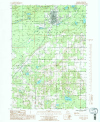
1985 Map of Kalkaska
USGS Topo · Published 1986About this map
The Kalkaska town center serves as the primary hub on this mid-1980s provisional survey, showing a concentrated grid of streets and infrastructure adjacent to the Boardman River. The landscape is defined by the heavy presence of the Pere Marquette State Forest, which covers much of the northwestern terrain, punctuated by numerous glacial lakes such as Smith Lake and Milk Lake. Transportation and utility corridors are clearly marked, including a landing strip north of town and several pipelines that cut across the county lines of Boardman and Orange townships.
Find a feature on this map
44 named features on this map. Tap any name to fly to it.
Don’t see what you’re looking for? This feature index may not catch every label — zoom into the map to look around manually.
Map Details
Editions of this 1985 Kalkaska Map
2 editions found
Other maps of this area

1954 · Traverse City
USGS Topo · 1:250,000

1956 · Mancelona
USGS Topo · 1:62,500

1956 · Kalkaska
USGS Topo · 1:62,500

1956 · Fife Lake
USGS Topo · 1:62,500

1957 · Elk Rapids
USGS Topo · 1:62,500

1958 · Traverse City
USGS Topo · 1:250,000

1983 · Traverse City
USGS Topo · 1:100,000
1983 · Torch River
USGS Topo · 1:24,000
1985 · Kalkaska
USGS Topo · 1:24,000
1985 · Sharon
USGS Topo · 1:24,000