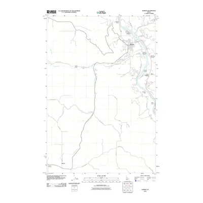
2010 Map of Kamiah
USGS Topo · Published 2010About this map
The Clearwater River serves as the focal point for this 2010 Idaho study, winding through a landscape defined by deep canyons and traditional settlements. Along its banks, the town of Kamiah and East Kamiah provide a contemporary look at life in the Clearwater Valley, while the surrounding plateaus are home to the small community of Winona. The presence of the Long Camp and ASA Smith Mission and the Heart of the Monster Point of Interest highlights the deep cultural and historical layers of this region.
Find a feature on this map
39 named features on this map. Tap any name to fly to it.
Don’t see what you’re looking for? This feature index may not catch every label — zoom into the map to look around manually.
Map Details
Editions of this 2010 Kamiah Map
This is the sole edition of this map. No revisions or reprints were ever made.
Other maps of this area

1924 · Kamiah
USGS Topo · 1:125,000

1924 · Weippe
USGS Topo · 1:125,000

1955 · Pullman
USGS Topo · 1:250,000

1956 · Hamilton
USGS Topo · 1:250,000

1958 · Pullman
USGS Topo · 1:250,000

1959 · Hamilton
USGS Topo · 1:250,000

1960 · Hamilton
USGS Topo · 1:250,000

1964 · Hamilton
USGS Topo · 1:250,000

1966 · Kooskia
USGS Topo · 1:24,000
1966 · Stites
USGS Topo · 1:24,000