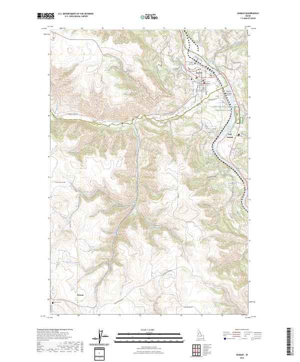
2024 Map of Kamiah
USGS Topo · Published 2024About this map
Nez Perce National Historical Park preserves a critical stretch of the Clearwater River valley where the town of Kamiah serves as a local hub. The geography is defined by steep draws and plateaus, with East Kamiah sitting across the river and the smaller settlement of Winona located to the southwest. The landscape is marked by several significant burial grounds, including the Teh LaPa Low Cem and Kamiah Cem near the town center, and the more remote Nikesa Cem and Winona Cem.
Find a feature on this map
64 named features on this map. Tap any name to fly to it.
Don’t see what you’re looking for? This feature index may not catch every label — zoom into the map to look around manually.
Map Details
Editions of this 2024 Kamiah Map
This is the sole edition of this map. No revisions or reprints were ever made.
Other maps of this area

1924 · Kamiah
USGS Topo · 1:125,000

1924 · Weippe
USGS Topo · 1:125,000

1955 · Pullman
USGS Topo · 1:250,000

1956 · Hamilton
USGS Topo · 1:250,000

1958 · Pullman
USGS Topo · 1:250,000

1959 · Hamilton
USGS Topo · 1:250,000

1960 · Hamilton
USGS Topo · 1:250,000

1964 · Hamilton
USGS Topo · 1:250,000

1966 · Kooskia
USGS Topo · 1:24,000
1966 · Stites
USGS Topo · 1:24,000