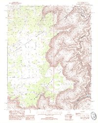
1988 Map of Kanab Point
USGS Topo · Published 1988About this map
Kanab Creek carves a deep path through this section of the Arizona landscape, where the Kaibab National Forest meets the northern reaches of Grand Canyon National Park. The topography is defined by high vantage points such as Kanab Point, Shanub Point, and Paguekwash Point, which overlook the dramatic descent toward the Colorado River at the bottom of the sheet. Evidence of early land use and survival in this arid environment is visible through the notation of a prospect and vital water sources like Showerbath Spring and North Spring.
Find a feature on this map
27 named features on this map. Tap any name to fly to it.
Don’t see what you’re looking for? This feature index may not catch every label — zoom into the map to look around manually.
Map Details
Editions of this 1988 Kanab Point Map
2 editions found
Other maps of this area

1886 · Kaibab
USGS Topo · 1:250,000

1953 · Grand Canyon
USGS Topo · 1:250,000

1954 · Heaton Knolls SE
USGS Topo · 1:24,000

1954 · Heaton Knolls
USGS Topo · 1:62,500

1957 · Grand Canyon
USGS Topo · 1:250,000

1957 · Jumpup Canyon
USGS Topo · 1:62,500

1958 · Grand Canyon
USGS Topo · 1:250,000

1960 · Grand Canyon
USGS Topo · 1:250,000

1962 · Kanab Point
USGS Topo · 1:62,500

1962 · Tuckup Canyon
USGS Topo · 1:62,500